No items found.


The project has a strong sustainable vision with many energy efficient design elements including tidal power, desalination, wind energy, solar power and more.
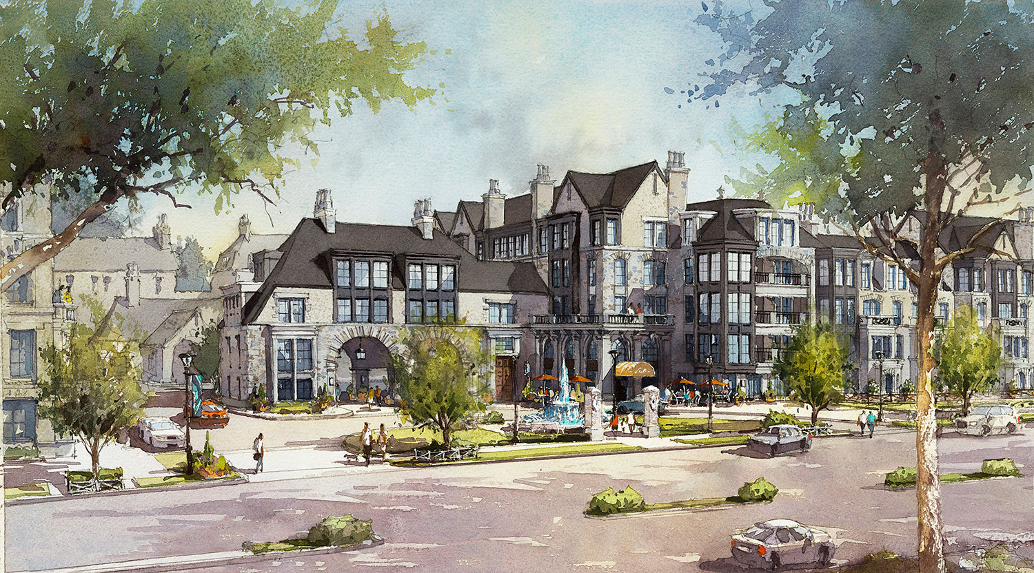
The Arabian Canal is a regional master plan for a new city in Dubai envisioned by Calthorpe Associates. Torti Gallas and Partners teamed with Calthorpe Associates to create a plan for one of the districts in the region called Urban Center 1. The Arabian canal master plan covers 196 square kilometers (about 75 square miles) and includes a 129 meter wide canal that passes through the new city and continues out to the Persian Gulf. The project incorporates a strong sustainable vision with several energy efficient design elements such as tidal power, desalination, wind energy, solar power, decentralized waste water treatment, infiltration, potable water technologies, xeriscape landscaping, etc. The region will be well connected by transit (street cars, light rail) and networks of streets and open spaces. The region is classified into several districts depending upon the mix of uses, densities and environments, one of which is Urban Center 1.
Urban Center 1 is approximately 12 square miles in area (about 10 neighborhoods) and is located at the western end of the master plan, acting as a gateway to the new city. This role as a gateway is reinforced by the canal opening into a wonderful marina that is well connected to the city through a network of open spaces and streets. The proposed grid of the city in the neighboring districts, including the main street car routes, extends through Urban Center 1 and deflects towards the marina and the regional transit station. A hierarchy of street systems is established within the urban center with boulevards, avenues, neighborhood major and minor streets. The canal and the marina are intercepted by a regional park that converges as it passes through the urban center. A regional multi-nodal transit station is situated at the end of this park axis, acting as an entrance and an important focal point for the region.
The canal is pinched before opening out into the marina by a “Ponte Vechio”, or a bridge supporting buildings, which looks onto a dramatic vista over the marina. The marina connects to a lock system which controls the water levels in the canal and boat travel to the gulf. The marina and the canal are embraced by promenades at the low end of the hill next to the water and the street grid slopes up from here creating terraces and dramatic views into the water. This urban center is composed of high rise (20- 30 stories) office and residential program with vibrant street level retail. Occasionally the street experience is enhanced by idiosyncratic “Souqs” (similar to bazaars). Intermittent shifts in the street grid, Souqs, shaded paths, and courtyards in the blocks bring variety and informality to the urban grid. Parks, plazas, and bridges create several vistas and moments within the center. This urban center and waterfront will create a vital place to live, work, and play within this new sustainable city in Dubai that is expected to support 3 million people within the next 20 years.


Interested in joining us? Every member of the TG+P team plays a key part in creating a more sustainable world.